 Catalogue PIGMA
Planning cadastre
Type of resources
Available actions
Topics
Keywords
Contact for the resource
Provided by
Years
Formats
Representation types
Scale
-

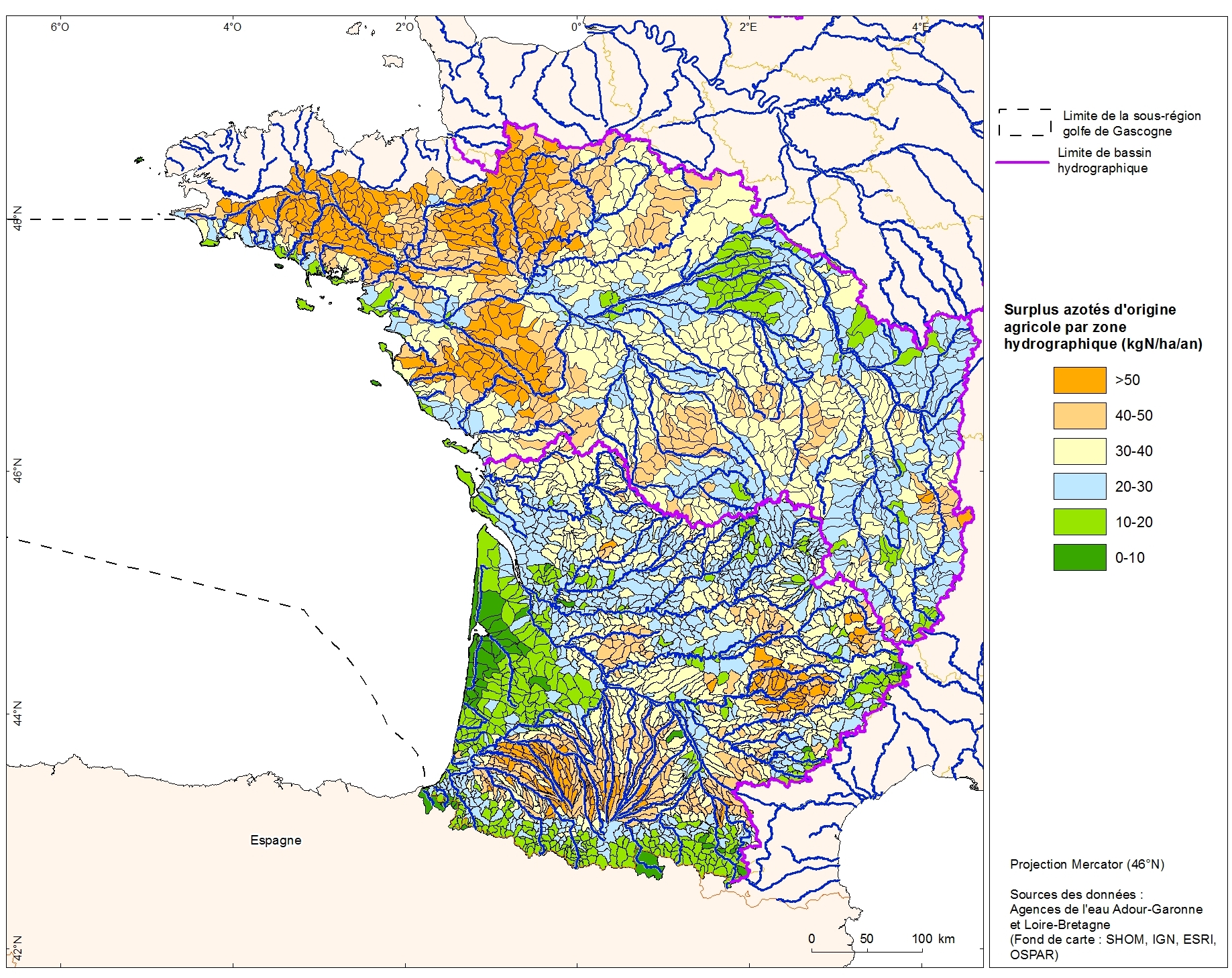
Excess nitrogen from agricultural drainage by hydrographic zone in the Adour-Garonne basin. This data was collected as part of the "initial state" phase of DCSSM with the Adour-Garonne Water Agency. Referent expert AAMP : Aurélie Blanck. Partial description of the fields: "kgN_ha_an" : nitrogen surplus (kgN / ha / year)
-
Excess nitrogen from agricultural drainage by hydrographic zone in the Loire-Bretagne basin. This data was collected as part of the "initial state" phase of DCSSM with the Loire-Bretagne Water Agency. Referent expert AAMP : Aurélie Blanck.
-
PCI vecteur
-

Il s'agit du diagnostic du SCOT et de l’état initial de l'environnement validé en 2014.
-
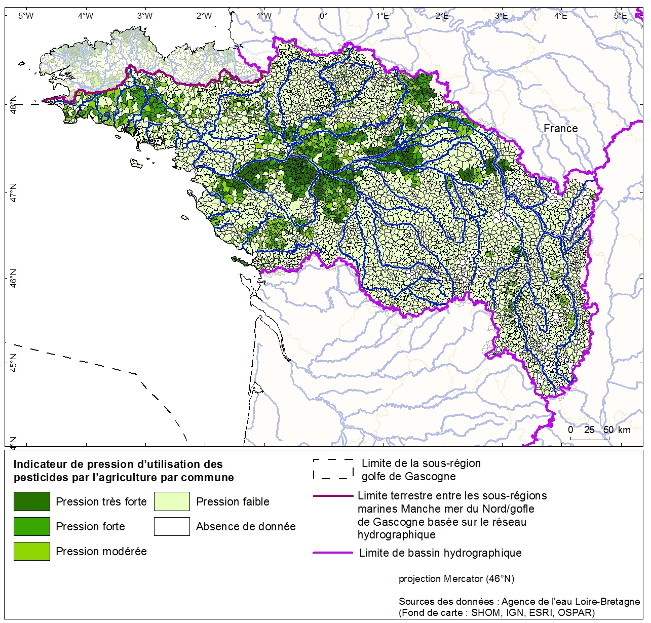
Pressure indication for agricultural pesticide use by canton of the Loire-Brittany basin. This data was collected as part of the initial assessment of the MSFD with the Water Agency of Loire-Bretagne. Referent expert AAMP: Aurélie Blanck.
-
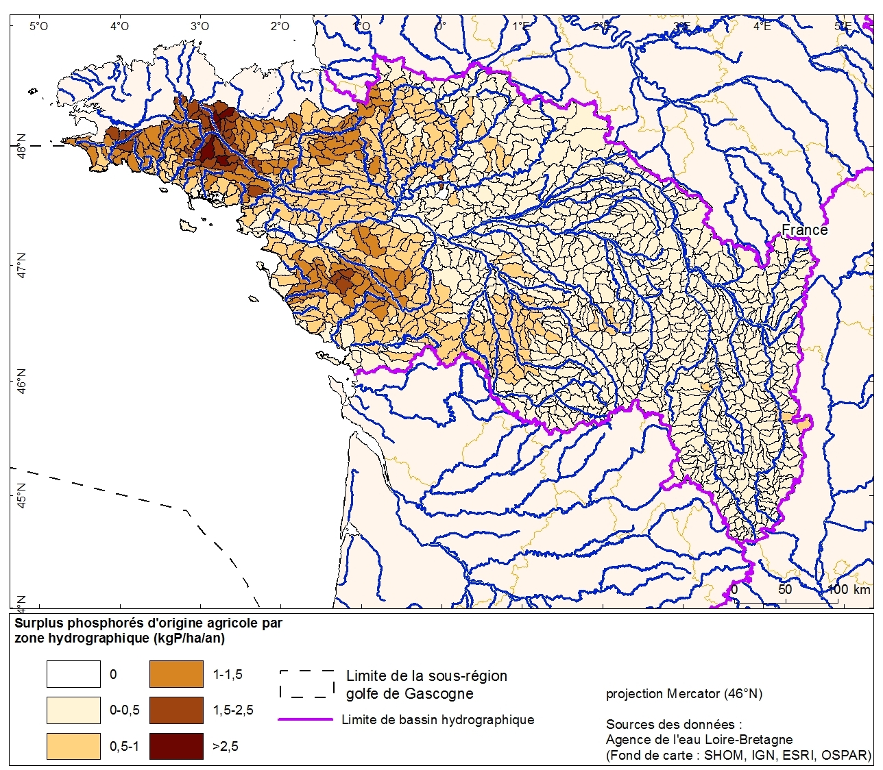
Excess phosphorus from agricultural drainage by hydrographic zone in the Loire-Bretagne basin. This data was collected as part of the "initial state" phase of DCSSM with the Loire-Bretagne Water Agency. Referent expert AAMP : Aurélie Blanck.
-

L’étalement urbain est une forme d’urbanisation qui s’est développée autour des agglomérations. Il entraine une artificialisation des sols qui produit des impacts sur l’environnement, sur le paysage et sur l’organisation des territoires. La lutte contre l’étalement urbain et l’artificialisation des sols au profit de formes urbaines denses et compactes est une priorité régionale qui implique de mettre en oeuvre une politique globale de maîtrise de la consommation des espaces naturels, agricoles et forestiers. L’Aquitaine est une région vaste et davantage artificialisée que la France métropolitaine. La densité de population est faible et l’Aquitaine arrive en 8ème position des régions occupant le plus d’espace artificialisé par habitant. Son fort dynamisme démographique accroît les pressions sur le foncier disponible, notamment autour des pôles d’emploi. Dans plusieurs aires urbaines, les sols s’artificialisent à un rythme bien supérieur à l’évolution de la population.
-
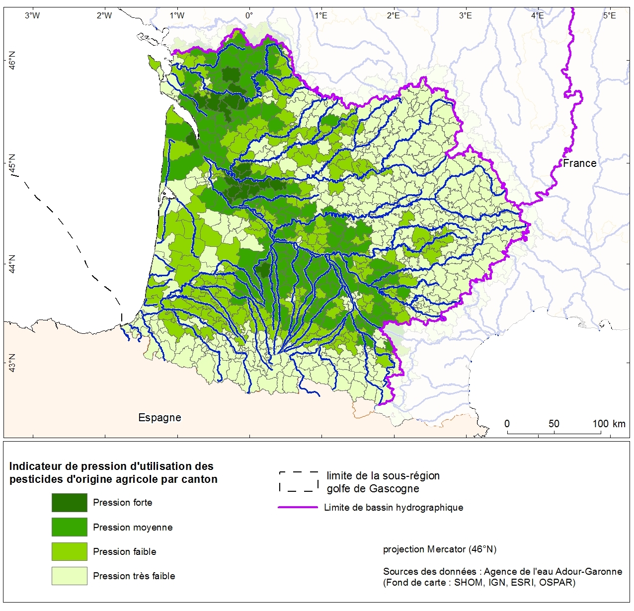
Pressure indication for agricultural pesticide use by the canton Adour-Garonne. This data was collected as part of the initial assessment of the MSFD with the Water Agency of Adour-Garonne. Referent expert AAMP: Aurélie Blanck.
-
PLU
-
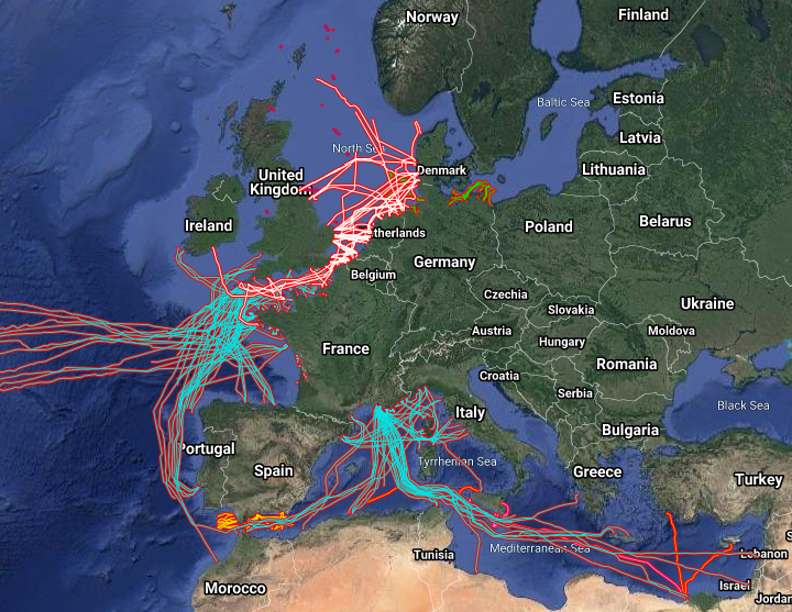
The datasets on subsea telecommunication and power cables (actual routes) in the EU was created in 2014 by Cogea for the European Marine Observation and Data Network (EMODnet). It is the result of the aggregation and harmonization of datasets provided by several sources. It is updated every year and is available for viewing and download on EMODnet Human Activities web portal (www.emodnet-humanactivities.eu). The datasets contain lines representing actual cable routes locations. Compared with the previous version, this version includes an update of the French telecommunication cables, the telecommunication cables that originate from or pass through Spanish (Andalucia) and Dutch waters, and the electric cables that originate from or pass through French, Dutch and Norwegian waters.